Tuesday, December 11, 2012

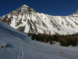
I first noticed this impressive north face last year from the vantage of the Lost River Range. A little research revealed it to be the Devil’s Bedstead East (as opposed to Devil’s Bedstead West). Pictures confirmed my suspicion that it would make a super classic ski decent. More recently I’ve learned that Chris Davenport et al included it in their new book 50 Classic Ski Descents of North America.  What do you think? 3,000+ feet


This picture was taken in June many years ago early in the morning. The obvious direct fall line off the summit will go this spring!


Easiest route to the summit. 3rd class in the summer. Avalanche death in the winter


The face as it appeared last weekend.


Devil's Bedstead West (not as cool). This mountain lies on the west side of Kane Creek, DBE is on the East side.


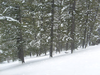
While approaching DBE, I passed through this avalanche path in disguise. The absence of low branches on the uphill sides of this trees is the sure sign.  Low snow pack  lacking instabilities made for a safe approach and awesome powder turns on the descent.


I left the trail head at noon, planning on a bivy around 10,000 feet near the North East Ridge. All went as planned on day one. Day two began with me learning all about how canister stoves don't work well when they're cold especially when you have the wrong fuel mixture. Then I learned that when my new 3 buckle ski boots are cold I can't get my feet into them. This was the coldest night of the year so far with lows reaching single digits 4,000 feet lower than me. I had no thermometer, but it was pretty stinkin' cold! I shoved everthing in my sleeping bag and went back to sleep. When I woke I promptly bailed. A few thousand feet of good powder turns in the avalanche forest pictured above was my consolation.

Tuesday, November 27, 2012

family cichlidae

Not quite enough snow to ski yet, so I traveled to an isolated high desert warm springs to collect specimins of the family cichlidae. I'm pretty sure (qualitative measure of probablility)  that this is the most diverse family of chordates. There are an estimated 2,000-3,000 species of cichlids with only about 1,300 classified. After failing with a casting net I was left with one option...as Jeremy Wade would say, "tackle up and get a line in the water!" I would guess that not many folks have cast flies to fish that are native to African lakes and South American jungles. Three different species from three seperate genuses were taken on nymphs and placed in my aquarium. A larger species of tillapia was taken on a dry fly as well as a nine inch goldfish.
         
Before leaving I sliced up one specimen and tried a little bait fishing (Jeremy Wade style). While I got nonstop action, my tackle was too big and I could not set the hook. Although, with polorized lenses I could clearly see at least six more species that had been roused from the deep by the live bait including the prized aquarium specimens that go by the common names of Jack Dempsey and Green Terror.

In this low quality video of my super stressed overcrowed tank, the Jack Dempsey and albino Oscar (Albino Diablo, Ghost Faced Killa's successor) came from the pet store. All the others are "wild".

Tuesday, October 23, 2012

Climb your local Norwand today!

The worst fire season in my experience has left me unfit and inflammed, but all that just ended. I packed up my ice gear and headed for the land of ogres and giants. At the trail head I drank a strong concoction prepared by extracting a certain "bean" with hot water. Cut with heavy wipping cream, this has been my favorite performance enhancer for over a decade now!

This face holds ice year round...some white glacial ice and several couloirs of black ice. I chose a route that I thought would allow the option of climbing ice or rock. I was treated to an alpine mess of moderate snow, WI III, and snowy class 3 rock with 4th class steps. Front pointing up a 45 degree 20 foot step of black ice with plenty of exposure proved to be the mental crux. This old ice gear works pretty good! Two hours and about 1,200 feet higher I was stopped by difficulties. I sat on a small ledge dumbfounded not only at the prospect of downclimbing the route, but also finding my way out the trailless canyon in the dark (I had optimistically planned on summiting in the late afternoon sun and walking down the standard trail in the dark). After accepting my situation I stood up only to see my cell phone fall from my pocked and accelerate seemingly without resistance. It hit a small ramp and cought hundreds of feet of air after which it landed on more steep snow and just kept on going. I sat back down...hmm. Well I suppose my cell phone had inproper gear and poor route finding skills. Heck! Two hours later I was  back on the frozen scree of the cirque floor. Three hours later I was doing steam crossings and bushwackings in the dark. My weary mind, now free from ogres and giants, pondered local extraterestrial lore such as cattle mutalations and strange men in bussiness suits making mountain traverses on foot in the winter. Then there's all the wolf stories...devil wolves 'round these parts. They get big as horses from eating cattle. Finally, forest gave way to sage and stars.Yada Yada...then, safe in my truck, I got temporarily lost on the dirt roads driving home. The Norwand? Unclimbable!


Access to the upper cirque neccessitated passage through this man-sized invagination in the rock!


View from my highpoint..notice boot tracks below


good taste of the face


Wintry Norwand contrasts with sage desert


North Face Mount Borah. Mid October 2012

Saturday, August 18, 2012

Summa twenny twelve


Not much photodocumentation this summer, but here it is. the consistantly cold rivers in glacier country aren't known to grow big trout...infact a "guide" told me there aren't many over 18".  Here's two of them, although the photographer failed. The second one was REALLY big.


After meeting with the sister and brother in law and catching a few fish, I spent four days hermiting and geeking out by collecting mineral samples between glacier and bozeman.


Sun sets early into the smoke in Idaho


These things grow on trees!

Tuesday, July 17, 2012

   Every summer, thou shalt ski these lines at least once


 This ski trip doubled as a geology field trip. clockwise from left: red shale, yellow shale, limestone, glacial conglomerate, cacite crystals cementing fragments of chert.


 Charlie Brown (foreground), good lookin' fella, and Cut Throat Killa' (background, my PG rated  fishing alter ego, also a good lookin' fella)


 Just a week ago Matt Johnson landed an anomolous 13 inch rainbow trout with a patchy red belly. We regreted not having cameras. This week, from the same creek, I landed three of these rainbows with gold tipped dorsals and had a camera. At least two of them were certainly different fish based on length. What is it? Is this creek laden with mutagens?


Also gold tipped, look close. These fish were strong and appeared healthy.

Wednesday, June 13, 2012

cross training

To maximize endurance and power its best to do some form of cross traing. While remaining completely focused on ski mountaineering, i've challenged my strength, reflexes and mental fortitude against the mighty trout (and female homo sapiens)...catch and release only! For the past few weeks I've relocated fish terrorism headquarters to Montana. When you're on the Pro Leisure Tour, this stuff is serious!


Friday, May 25, 2012

Borah

My first attempt at Borah ended at the base of chicken out ridge because I had no crampons. Attempt two ended at the snowbridge which looked horifying due to newly drifted snow. The above picture represents my high point of try number three. While stopped by the NE ridge, I did get a really good look at the north face...not that steep.

Try number three also had the benefit of sick corn turns from the 12,000 ridge. I was duanted by the approach up "trailless" Rockcreek, but in retrospect it might be the easiest three miles in the Lost River Range thanks to the excellent description available on summitpost by reboyles.

For try number 4 I chose a different route, a West Face snow couloir, and opted for a planned bivy. Ariving at my bivy spot, I eyed my route and knew it would go!

Here it is, up the blue dots to the summit, ski back down the blue dots to the big rock traverse. Then traverse to the green dots and ski the snowbridge couloir! Awsome bivy spot, eh?

Arriving at the summit at 11:00 I expected to ski immediately, however, for the first trime ever, a forcasted mostly sunny day in the Big Lost River Valley turned mostly cloudy forcing me to shiver in fetal position on my pack behind this windblock for 2 hours waiting for the snow to soften. This always happens to me, heck!

Me with some of the trash I found on the summit

Looking back at the summit from near the top of the snowbridge showing the line I skied off the summit. Yes, the steep line on the left is pretty high on my list. I had perfect corn off the summit in a window of sunshine. The snowbridge coulie also had perfect corn and was spiced up by many prodruding rock fins, my favorite!
Looking South from the summit. The green arrow shows my high point and ski descent from last month on Leatherman.
Next year, a bigger snowpack will allow a more thorough exploration of these mountains.

Monday, April 23, 2012

one of six over 18 inches after work last week. This one was over two feet! Sorry buddy, go back to spawning.

looking up at "Super Gully" from  almost 10,000 feet. I accended the gully and ridge system to the climber's right of Super Gully. Firm snow made for excellent cramponing.  I counted 10 different ways to walk uphill with crampons.

Looking down Super Gully from  over 12,000 feet, wondering if it will thaw. In the middle of a perfect weather window...high pressure, hight temps, no clouds...orographic lifting sometimes squeezes out just a bit more moisture from the atmosphere, enough to produce intermittent clouds near the summit, preventing my line from thawing. Dang it! No shame, I side stepped the first 400 feet or so, then skied in survival mode for a few hundered more feet. That first third of the gully took about half an hour and a few more nanometers of my hairline. The last two thirds  had  thawed and took me about one minute to ski during which  time my hairline actually advanced several nanometers!

False summit, the real summit is 1/3 of a mile farther but only 50 feet higher.

This is looker's left of Super Gully. I climbed to this point, about 11,000 feet, and waited for the surface to thaw, but it never did. Note water ice.

Mountains, desert, reservoir

Trail Head

Lost River Peak, April 2012

Monday, April 9, 2012


These shoes need to be a half size bigger. After showering in these shoes I wore them as long as i could. Then, to avoid shrinkage...


Actually, its still skiing season. I headed back up towards Leatherman Pass and made my way up the north ridge of that peak. At some point I was stopped by steep snow covered rocks. To glisse the face just east of the ridge seemed like the best option (first photo). Two or three nice couloirs were draped down the face. Ankle deep powder at 45 degrees for about 1,500 feet took me to a horizon line which, nicely, turned out to not be death cliffs...mearly a rollover of a few degrees which led quickly to lower angle slopes and then the floor of the basin (photo with sick tracks).


As an after thought, I figured I'd go around and try to summit via the west face. I made it a few hundered feet closer, but was stopped by exhaustion. I then skied one of the biggest, best corn runs of my life, but was too waxed to fully enjoy the ride.

Monday, April 2, 2012

LRR heating up


The wetter snow of spring is apparently what it takes to stick to Lost River Range. A few good freeze/thaws has ensured that the snow will not blow away. Finally, endless scree has been transformed to a cruiser skin track.


I headed up sawmill gulch which, if you have an ATV, can be followed with some difficulty pert near the pass between the two named peaks in the photo. I grew up in the suburbs, so my vehicle only made it about a mile past where this photo was taken.


April fools day...after an hour of hiking and two hours of skinning I discovered that I had inadvertantly brought more than the usual 1.5 litres of water. Somehow I had four litres!


As sometimes happens, I forgot my camera (ipod). The image I most regrett not having is one of the titanic leatherman, splitting sawmill gulch with its perfect equillateral triangle burning white. Pretty much looked like K2 from that aspect. From there I headed climbers left toward the unnamed summit on the photo's left (with green arrow). This pittance of a summit tops out at only 11,000 ft. The looker's right couloir off the summit went well. Warm weather the week prior gave rise to several point releases, but no fracturing. On this day everything was frozen solid and covered in an inch of fresh...and no wind! After negotiating rocks and avi debris the chute turned into a low angle half pipe full of ankle deep pow that extended well below tree line. This run had it all: steeps, tech, rocks, ice, vert, pow, location, access! 2,300 feet.

Wednesday, March 21, 2012

nice little 1,000 foot stash. I skied laps on this after 15 inches of dense snow had fallen in the absence of wind. I returned the next day (picture) to find the slope rendered useless by the night's gale.


Chemistry tricks...Slow precipitation of lead iodide produces gold! The flourence flask shows the positive result of a Tollen's test, pure silver precipitate lining the vessel.


Cut throat killa'! 18" spawning female. Lived to spawn.


This specimin had an unusually large head and small right arm


Latest route on Dickey Peak.


I managed to reach the false summit. The run turned out to be much steeper than I thought, yikes! The dagger mounted on my ski pole for fending off mountain lions doubles as a self arrest tool in situations like this. No sign of avalanches, nonetheless I skied close to the rock/snow line on the uphill side of the gully. Being solo means that most (?!) of the routes I've skied this year have been chosen specifically because they present this option.


The last few weeks of snow and cloud cover have really saved the spring ski season in the LRR, still pretty slim though. In contrast, on the other side of the valley, Smiley Mountain Snotel site reported over 8 inches of SWE in about 10 days, more than doubling the snow pack!!